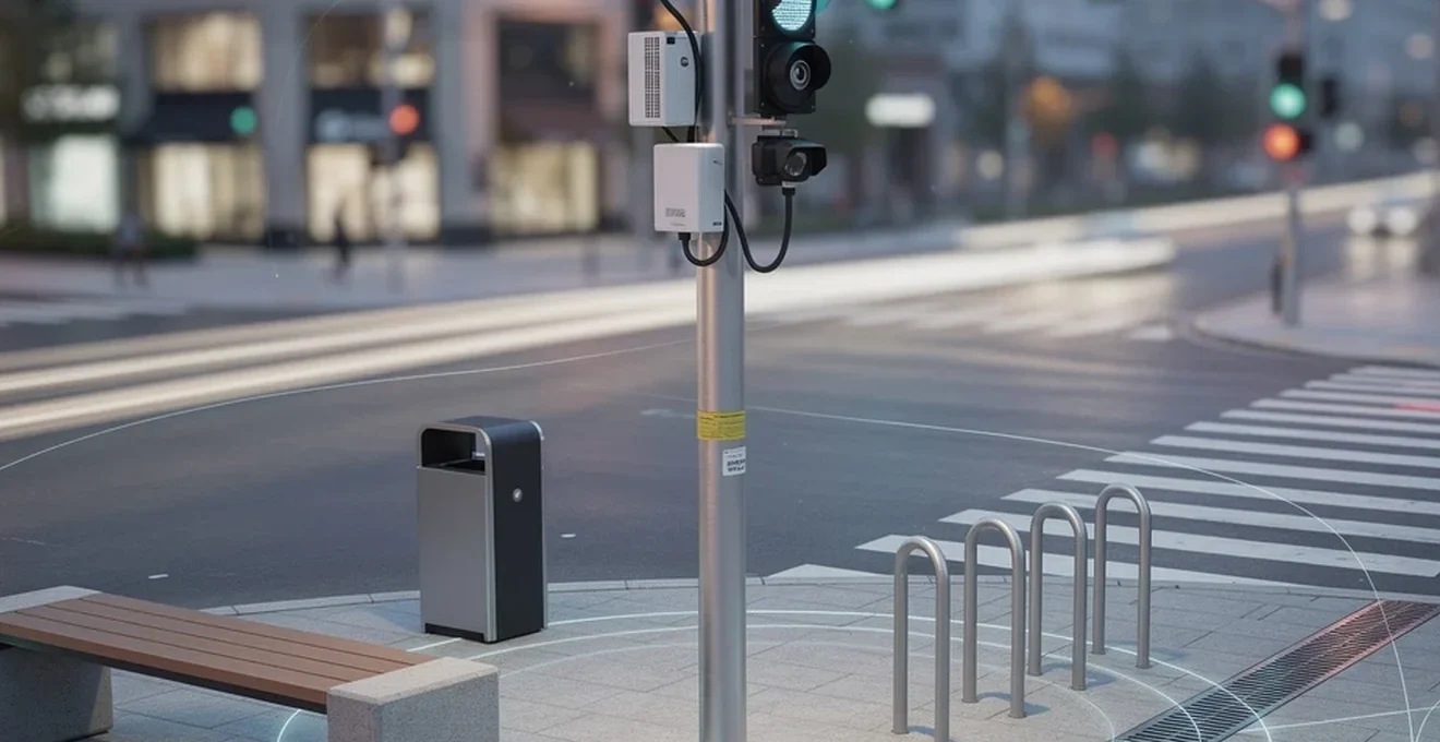
Behind every well-functioning city lies a vast, often invisible network of physical equipment. Strategic frameworks and design principles set the direction for urban development, but it is the hardware—traffic signals, bollards, drainage channels, streetlights, waste systems and sensor networks—that turns planning vision into daily reality. This equipment determines whether a pedestrian crossing feels safe, whether a storm drains without flooding a high street, or whether a city council can spot an air quality problem before it becomes a public health crisis. Understanding the tools and systems that make urban environments function gives planners, developers and infrastructure managers a practical foundation for delivering safer, more efficient and more resilient places. The following sections examine the core categories of urban equipment shaping modern cities, from traffic management and street furniture through to drainage, lighting, waste handling and the digital infrastructure underpinning smart city ambitions.
Traffic management infrastructure and intelligent transport systems
Traffic management equipment sits at the intersection of safety, efficiency and urban design. As cities grow denser, the physical and digital systems that regulate vehicle and pedestrian movement must work harder to prevent congestion, reduce collisions and support the multi-modal transport choices that planners increasingly prioritise.
Adaptive traffic signal control with SCATS and SCOOT algorithms
Adaptive traffic signal systems adjust signal timing in real time based on actual traffic conditions rather than fixed schedules. These systems use sensors embedded in the road or mounted on poles to detect vehicle volumes and adjust green-light durations accordingly, reducing unnecessary idling and improving traffic flow through busy junctions. This approach aligns with the broader Complete Streets philosophy, where roadways must serve pedestrians, cyclists, transit users and drivers simultaneously rather than prioritising vehicle throughput alone.
Bollards, barriers and pedestrian segregation hardware
Bollards perform several distinct functions in the urban realm: they delineate pedestrian zones from vehicle areas, guide foot traffic along safe routes, and provide protection against vehicle incursion into crowded spaces such as storefronts and pedestrian plazas. Crash-rated bollards built to recognised safety standards are increasingly specified for high-footfall areas where vehicle-pedestrian separation is a safety priority. Beyond their protective role, bollards support the natural surveillance and access control principles found in Crime Prevention Through Environmental Design, helping to define clear boundaries between public and semi-public space without creating visual obstructions or hiding spots.
ANPR cameras and congestion charging zones like london’s ULEZ
Automatic Number Plate Recognition (ANPR) cameras form the backbone of congestion charging and low-emission zone enforcement. These systems capture vehicle registrations as they enter designated zones, cross-referencing them against compliance databases to apply charges or penalties automatically. This equipment supports wider environmental and traffic-reduction goals by discouraging non-compliant vehicle trips into city centres, complementing the density and mixed-use strategies planners use to reduce car dependency.
Smart parking sensors and Real-Time occupancy guidance systems
Ground-mounted or overhead sensors detect whether individual parking bays are occupied, feeding data into apps and digital signage that direct drivers to available spaces. By reducing the time vehicles spend circling in search of parking, these systems cut unnecessary congestion and emissions while improving the overall experience of visiting a town or city centre.
Street furniture and public realm equipment
Street furniture does more than furnish pavements—it actively shapes how people use public space, encouraging legitimate activity, supporting natural surveillance and making streets more comfortable for extended use.
Modular bench systems from manufacturers such as marshalls and broxap
Modular bench systems allow councils and developers to configure seating to fit specific site dimensions and design intentions. Well-placed benches encourage people to linger in public spaces, supporting the « eyes on the street » principle that underpins natural surveillance and helps deter opportunistic crime. Seating also improves accessibility for older residents and those with mobility limitations, directly supporting the comfort principle found in quality urban design frameworks.
Litter bins and Solar-Powered compaction units like bigbelly
Solar-powered compaction bins compress waste automatically, increasing capacity and reducing the frequency of collection rounds needed in high-footfall areas. Some units include fill-level sensors that notify waste teams when collection is required, allowing councils to move from fixed collection schedules to responsive, data-driven servicing.
Bollard lighting and Low-Level LED wayfinding fixtures
Lit bollards combine the physical separation function of standard bollards with integrated lighting that improves visibility along pedestrian routes after dark. Positioned at human scale, these fixtures illuminate footpaths without the glare associated with taller street lighting, helping pedestrians navigate safely while reducing hiding spots that could otherwise undermine perceived safety. Many modern installations use energy-efficient LED technology and can be solar-powered, aligning wayfinding infrastructure with broader sustainability goals.
Cycle racks, sheffield stands and Bike-Share docking stations
Cycle parking infrastructure, from simple Sheffield stands to fully integrated bike-share docking stations, supports the multi-modal transport choices that reduce car dependency in dense urban areas. Bike-share systems in particular extend the practical reach of public transit by solving the first-mile and last-mile connection problem, making transit-oriented neighbourhoods more viable even where stations are not within immediate walking distance of every destination.
Urban drainage and stormwater management systems
As climate change increases the frequency of intense rainfall events, stormwater infrastructure has become a central concern for planners seeking to protect property, public safety and water quality.
Sustainable urban drainage systems (SuDS) components
Sustainable Urban Drainage Systems mimic natural water processes, slowing and filtering rainfall before it enters watercourses or sewer networks. Components such as bioswales and rain gardens capture and treat surface water close to where it falls, reducing the burden on downstream infrastructure while also contributing to urban greening and biodiversity goals. These nature-based approaches frequently prove more cost-effective than conventional piped drainage while delivering valuable co-benefits, including reduced urban heat and improved air quality.
Permeable paving and aco drainage channel networks
Permeable paving allows rainwater to infiltrate through the surface rather than running off into drains, reducing peak flow rates during storm events. Surface drainage channel systems complement this by directing any excess water safely away from pedestrian and vehicle areas, an especially important consideration in dense urban environments where impermeable surfaces dominate.
Attenuation tanks and combined sewer overflow controls
Attenuation tanks store excess stormwater temporarily during peak rainfall, releasing it gradually once capacity in the sewer network becomes available. This equipment is particularly critical in older cities where combined sewer systems—designed over a century ago—were never built to handle contemporary volumes of both wastewater and stormwater. Where legislative and population pressures have exceeded the capacity of ageing sewer infrastructure, cities have had to invest in major tunnelling and storage projects to relieve the strain on systems installed generations earlier.
Public lighting and Energy-Efficient illumination networks
Lighting infrastructure serves dual purposes in urban planning: it enables safe movement after dark and acts as a foundation for broader smart city and energy efficiency initiatives.
LED streetlight retrofitting and CMS control nodes
Retrofitting older sodium or mercury-vapour streetlights with LED fixtures significantly reduces energy consumption while improving light quality and colour rendering. Control nodes fitted to individual fixtures allow councils to monitor performance and energy use remotely, flagging faults before they result in extended outages that could compromise pedestrian safety.
Solar hybrid lighting columns for Off-Grid applications
Solar hybrid lighting columns combine photovoltaic panels with battery storage, allowing illumination in locations where grid connection is impractical or expensive. These installations are particularly valuable for pathways, parks and transit stops in areas still being developed, supporting pedestrian safety without waiting for full utility infrastructure to be built out.
Telensa and central management systems for remote dimming
Central management systems allow entire streetlight networks to be dimmed, brightened or scheduled remotely based on time of day, weather conditions or reported activity levels. This capability supports both energy savings and safety, since lighting levels can be increased dynamically in response to specific events or reported incidents rather than remaining fixed year-round.
Waste collection and municipal sanitation equipment
Waste infrastructure has a direct bearing on street cleanliness, public health and the overall perception of safety and care within a neighbourhood—closely tied to the maintenance principle found in environmental design frameworks.
Underground waste containers and vacuum collection systems like envac
Underground and vacuum-based waste collection systems remove the need for surface-level bins and the collection vehicles that service them on a frequent basis. Waste is transported via underground pipe networks to centralised collection points, reducing street clutter, noise and vehicle movements in dense residential and commercial districts.
Recycling segregation units and kerbside collection vehicles
Segregated recycling infrastructure, from multi-stream street bins to specialised kerbside collection vehicles, supports municipal recycling targets while reinforcing the visible commitment to environmental stewardship that residents increasingly expect from well-managed cities. Effective segregation at the point of collection reduces contamination rates and improves the economic viability of downstream recycling processes.
Digital infrastructure supporting smart city deployment
Smart city initiatives depend on physical digital infrastructure embedded throughout the urban environment, connecting sensors, networks and analytical platforms to give planners and residents real-time insight into how a city is functioning.
Iot sensor networks for air quality monitoring such as breathe london
Distributed air quality sensor networks provide granular, real-time data on pollution levels across a city, far more detailed than the readings available from a handful of fixed monitoring stations. This data allows planners and public health officials to identify pollution hotspots, evaluate the impact of low-emission zones, and target interventions where they will have the greatest effect on air quality and public health.
5G small cell installation on street furniture assets
Small cell 5G infrastructure is increasingly mounted on existing street furniture such as lamp posts and traffic signal poles, avoiding the need for large dedicated masts in dense urban areas. This approach reduces visual clutter while extending the high-bandwidth, low-latency connectivity required to support other smart city applications, from adaptive traffic signals to real-time parking guidance.
Digital twin platforms including CityEngine and cesium
Digital twin platforms create detailed virtual models of the built environment, integrating data from GIS systems, sensor networks and 3D imagery to simulate how a city functions and responds to change. Planners use these tools to test proposed interventions—new developments, infrastructure investments or policy changes—before committing to physical construction, supporting the kind of evidence-based, scenario-driven decision-making that underpins modern urban planning practice. As sensor networks and IoT connectivity expand, these platforms are increasingly capable of reflecting real-time conditions rather than static snapshots, moving cities closer to genuinely responsive, data-driven management.